| Item Detail |
| |
| |
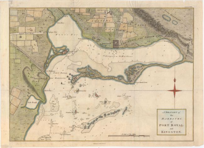
MapMaker: |
Thomas Kitchin
|
|
| |
| |
Subject: |
Kingston, Jamaica |
|
| |
Period/Size: |
1774 / 12.5" x 17.2" (31.8 x 43.7 cm)
|
|
| |
Color: |
Colored
|
|
| |
Condition: |
(B+) Issued folding, now pressed, with a "Herbert & Durnford" watermark and very light offsetting and foxing. There are archival repairs to a couple of tiny holes at fold intersections and to a short tear that just passes neatline at top. Remargined at (condition help) |
|
| |
Source: |
The History of Jamaica |
|
| |
References: |
Kapp (MCC-42) #100. |
|
| |
|
|
| Sales Information |
| |
| |
Price: |
|
|
| |
| |
Offered by: |
Old World Auctions |
|
| |
Catalog: |
Auction No. 154 - Antique Maps, Charts, Atlases & Globes (9277) |
|
| |
Lot/Item #: |
336 |
|
| |
| |
Date: |
09/2015
|
|
| |
| |
|