Title:
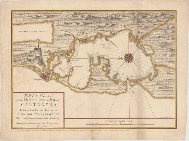
“This Plan of the Harbour, Town, and Forts, of Cartagena, Is Most Humbly Inscribed to the Rt. Honble. Sir Charles Wager First Lord Commissioner of the Admiralty...”
Map Maker:
William Henry Toms
This scarce chart of Cartagena was published just ... (full text available to subscribers)
| Item Detail |
| |
| |
MapMaker: |
William Henry Toms
|
|
| |
| |
Subject: |
Cartagena, Colombia |
|
| |
Period/Size: |
1740 / 16.6" x 22.8" (42.2 x 58.0 cm)
|
|
| |
Color: |
Colored
|
|
| |
Condition: |
(B) A nice impression with light soiling. Issued folding with a long separation along the right-hand fold that has been archivally repaired, as well as some toning along the fold. (condition help) |
|
| |
Source: |
|
|
| |
References: |
Kapp (MCC-77) #66. |
|
| |
|
|
| Sales Information |
| |
| |
Price: |
|
|
| |
| |
Offered by: |
Old World Auctions |
|
| |
Catalog: |
Auction No. 154 - Antique Maps, Charts, Atlases & Globes (9277) |
|
| |
Lot/Item #: |
356 |
|
| |
| |
Date: |
09/2015
|
|
| |
| |
|
Antique Maps - Valuation and Pricing, Descriptions, Resources |
|
Home |
Information |
Search |
Register |
Contact Us |
Site Map
Americana Exchange, Inc. © 1999 - 2024 Americana Exchange, Inc.. All rights reserved.
OldMaps.com, the OldMaps.com logo and
AMPR are service marks or registered service marks of Americana Exchange, Inc..
|