Title:
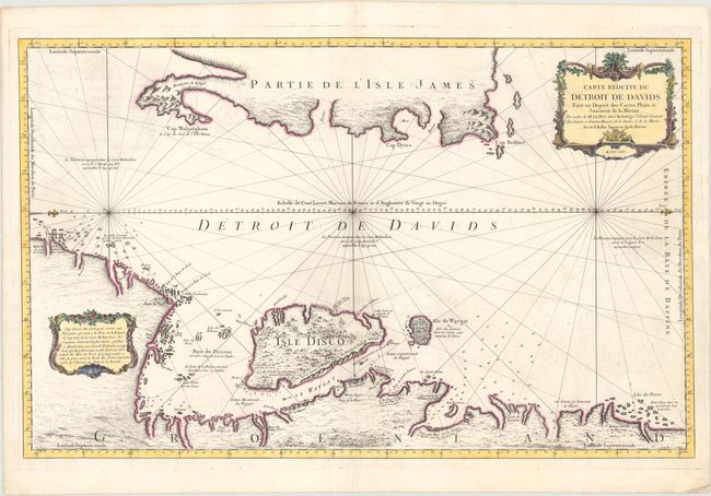
“Carte Reduite du Detroit de Davids Faite au Depost des Cartes Plans et Journaux de la Marine...”
Map Maker:
Jacques Nicolas Bellin
This large-scale sea chart of the Davis Strait was... (full text available to subscribers)
| Item Detail |
| |
| |
MapMaker: |
Jacques Nicolas Bellin
|
|
| |
| |
Subject: |
Greenland, Canada |
|
| |
Period/Size: |
1765 / 21.4" x 34.0" (54.4 x 86.4 cm)
|
|
| |
Color: |
Colored
|
|
| |
Condition: |
(B+) A dark impression on a sturdy watermarked sheet with light offsetting and some faint spots. (condition help) |
|
| |
Source: |
|
|
| |
References: |
|
|
| |
|
|
| Sales Information |
| |
| |
Price: |
|
|
| |
| |
Offered by: |
Old World Auctions |
|
| |
Catalog: |
Auction No. 154 - Antique Maps, Charts, Atlases & Globes (9277) |
|
| |
Lot/Item #: |
394 |
|
| |
| |
Date: |
09/2015
|
|
| |
| |
|
Antique Maps - Valuation and Pricing, Descriptions, Resources |
|
Home |
Information |
Search |
Register |
Contact Us |
Site Map
Americana Exchange, Inc. © 1999 - 2024 Americana Exchange, Inc.. All rights reserved.
OldMaps.com, the OldMaps.com logo and
AMPR are service marks or registered service marks of Americana Exchange, Inc..
|