Title:
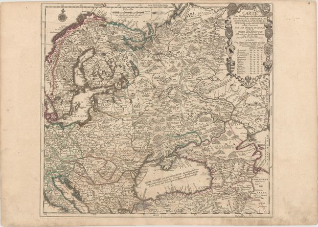
“Carte pour l'Intelligence des Affaires Presente, des Turcs, des Tartares, des Hongrois, des Polonois, des Suedois, et des Moscovites aux Environs de la Mer Noire et de la Mer Baltique...”
Map Maker:
Nicolas de Fer
This fascinating map of Eastern Europe and the Rus... (full text available to subscribers)
| Item Detail |
| |
| |
MapMaker: |
Nicolas de Fer
|
|
| |
| |
Subject: |
Eastern Europe, Russia |
|
| |
Period/Size: |
1711 / 20.9" x 22.6" (53.1 x 57.4 cm)
|
|
| |
Color: |
Colored
|
|
| |
Condition: |
(B+) Original color on watermarked paper with wide margins and light soiling. There is an old tape stain adjacent to centerfold at bottom that has been removed and professionally repaired with a tiny amount of image in facsimile. (condition help) |
|
| |
Source: |
Atlas ou Recueil de Cartes Geographiques |
|
| |
References: |
Pastoureau, FER II C [59]. |
|
| |
|
|
| Sales Information |
| |
| |
Price: |
|
|
| |
| |
Offered by: |
Old World Auctions |
|
| |
Catalog: |
Auction No. 154 - Antique Maps, Charts, Atlases & Globes (9277) |
|
| |
Lot/Item #: |
541 |
|
| |
| |
Date: |
09/2015
|
|
| |
| |
|
Antique Maps - Valuation and Pricing, Descriptions, Resources |
|
Home |
Information |
Search |
Register |
Contact Us |
Site Map
Americana Exchange, Inc. © 1999 - 2024 Americana Exchange, Inc.. All rights reserved.
OldMaps.com, the OldMaps.com logo and
AMPR are service marks or registered service marks of Americana Exchange, Inc..
|