| Item Detail |
| |
| |
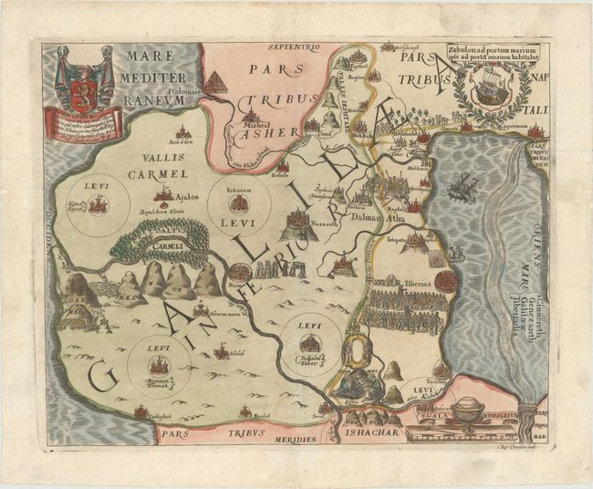
MapMaker: |
Thomas Fuller
|
|
| |
| |
Subject: |
Holy Land |
|
| |
Period/Size: |
1650 / 10.8" x 13.5" (27.5 x 34.3 cm)
|
|
| |
Color: |
Colored
|
|
| |
Condition: |
(A) Attractive impression and color on watermarked paper with some small worm holes that have been professionally infilled, only two of which appear within the image. (condition help) |
|
| |
Source: |
A Pisgah-Sight of Palestine |
|
| |
References: |
Laor #285; Nebenzahl (HL) p.128-131, #8; Shirley (BL Atlases) G.FULL-1a #7. |
|
| |
|
|
| Sales Information |
| |
| |
Price: |
|
|
| |
| |
Offered by: |
Old World Auctions |
|
| |
Catalog: |
Auction No. 154 - Antique Maps, Charts, Atlases & Globes (9277) |
|
| |
Lot/Item #: |
617 |
|
| |
| |
Date: |
09/2015
|
|
| |
| |
|