| Item Detail |
| |
| |
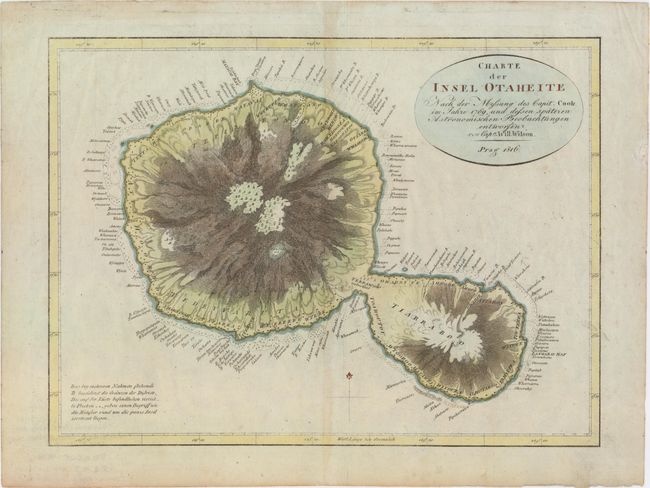
MapMaker: |
James Cook
|
|
| |
| |
Subject: |
Tahiti |
|
| |
Period/Size: |
1816 / 10.8" x 14.5" (27.5 x 36.9 cm)
|
|
| |
Color: |
Colored
|
|
| |
Condition: |
(A) Watermarked paper with attractive color and a hint of toning along centerfold. There is a short, archivally repaired tear in the right blank margin and some light printer's ink residue. (condition help) |
|
| |
Source: |
|
|
| |
References: |
|
|
| |
|
|
| Sales Information |
| |
| |
Price: |
|
|
| |
| |
Offered by: |
Old World Auctions |
|
| |
Catalog: |
Auction No. 154 - Antique Maps, Charts, Atlases & Globes (9277) |
|
| |
Lot/Item #: |
738 |
|
| |
| |
Date: |
09/2015
|
|
| |
| |
|