Title:
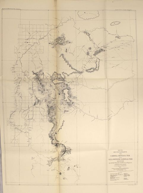
“Report of a Reconnaissance from Carroll, Montana Territory, on the Upper Missouri, to the Yellowstone National Park, and Return, Made in the Summer of 1875”
Map Maker:
William Ludlow
Carl Wheat hypothesizes that Capt. William Ludlow ... (full text available to subscribers)
| Item Detail |
| |
| |
MapMaker: |
William Ludlow
|
|
| |
| |
Subject: |
Exploration & Surveys, Montana |
|
| |
Period/Size: |
1876 / 12.0" x 9.4" (30.5 x 23.9 cm)
|
|
| |
Color: |
Black & White
|
|
| |
Condition: |
(A) Maps are clean, crisp and near fine. The large folding map of Carroll Road has light toning along one fold and a short binding tear confined to the left blank margin. Text is also clean. Binding is tight with the exception of one signature which is (condition help) |
|
| |
Source: |
|
|
| |
References: |
Wheat (TMW) #1257-1259; Howes #L-557. |
|
| |
|
|
| Sales Information |
| |
| |
Price: |
|
|
| |
| |
Offered by: |
Old World Auctions |
|
| |
Catalog: |
Auction No. 154 - Antique Maps, Charts, Atlases & Globes (9277) |
|
| |
Lot/Item #: |
779 |
|
| |
| |
Date: |
09/2015
|
|
| |
| |
|
Antique Maps - Valuation and Pricing, Descriptions, Resources |
|
Home |
Information |
Search |
Register |
Contact Us |
Site Map
Americana Exchange, Inc. © 1999 - 2024 Americana Exchange, Inc.. All rights reserved.
OldMaps.com, the OldMaps.com logo and
AMPR are service marks or registered service marks of Americana Exchange, Inc..
|