Title:
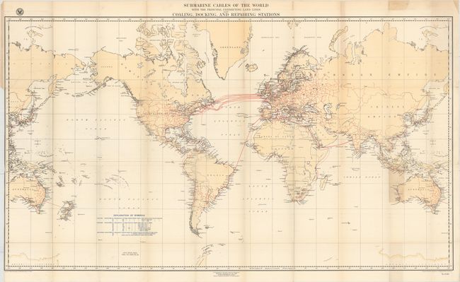
“Submarine Cables of the World with the Principal Connecting Land Lines Coaling, Docking, and Repairing Stations”
Map Maker:
U.S. Hydrographic Office
A large and fascinating map (drawn on Mercator's p... (full text available to subscribers)
| Item Detail |
| |
| |
MapMaker: |
U.S. Hydrographic Office
|
|
| |
| |
Subject: |
World |
|
| |
Period/Size: |
1896 / 27.0" x 47.7" (68.6 x 121.2 cm)
|
|
| |
Color: |
Colored
|
|
| |
Condition: |
(B+) Issued folding with faint toning along the folds and the top blank margin. There are a few tiny splits at fold intersections closed on verso with archival tape, a binding trim at left, and an adjacent 6" binding tear through Russia that has also bee (condition help) |
|
| |
Source: |
National Geographic Magazine |
|
| |
References: |
|
|
| |
|
|
| Sales Information |
| |
| |
Price: |
|
|
| |
| |
Offered by: |
Old World Auctions |
|
| |
Catalog: |
Auction No. 155 - Antique Maps, Charts, Atlases & Globes (9278) |
|
| |
Lot/Item #: |
28 |
|
| |
| |
Date: |
11/2015
|
|
| |
| |
|
Antique Maps - Valuation and Pricing, Descriptions, Resources |
|
Home |
Information |
Search |
Register |
Contact Us |
Site Map
Americana Exchange, Inc. © 1999 - 2024 Americana Exchange, Inc.. All rights reserved.
OldMaps.com, the OldMaps.com logo and
AMPR are service marks or registered service marks of Americana Exchange, Inc..
|