| Item Detail |
| |
| |
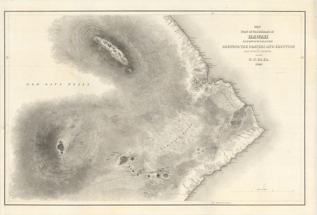
MapMaker: |
Charles Wilkes
|
|
| |
| |
Subject: |
Hawaii |
|
| |
Period/Size: |
1841 / 15.4" x 23.7" (39.2 x 60.2 cm)
|
|
| |
Color: |
Black & White
|
|
| |
Condition: |
(A) A dark impression on a mostly clean sheet, issued folding, with a few very faint stains. There is a binding trim at lower left that has been replaced with old paper and an associated tiny repaired binding tear that just touches the neatline. (condition help) |
|
| |
Source: |
U.S. Exploring Expedition |
|
| |
References: |
|
|
| |
|
|
| Sales Information |
| |
| |
Price: |
|
|
| |
| |
Offered by: |
Old World Auctions |
|
| |
Catalog: |
Auction No. 155 - Antique Maps, Charts, Atlases & Globes (9278) |
|
| |
Lot/Item #: |
254 |
|
| |
| |
Date: |
11/2015
|
|
| |
| |
|