Title:
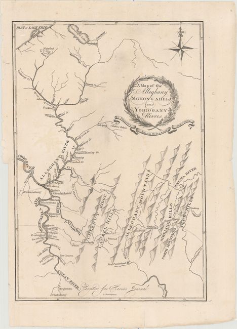
“A Map of the Alleghany Monongahela and Yohiogany Rivers”
Map Maker:
Thomas Wightman
This is only the second time we've encountered thi... (full text available to subscribers)
| Item Detail |
| |
| |
MapMaker: |
Thomas Wightman
|
|
| |
| |
Subject: |
Western Pennsylvania |
|
| |
Period/Size: |
1805 / 13.0" x 9.0" (33.1 x 22.9 cm)
|
|
| |
Color: |
Black & White
|
|
| |
Condition: |
(B+) Issued folding and now flattened and backed with tissue. There are two short edge tears that just touch the border at left and one small area of faint offsetting. (condition help) |
|
| |
Source: |
Journal of a Tour in the Territory Northwest of the Allegheny Mountains… |
|
| |
References: |
Phillips (Maps) pp. 99 & 680. |
|
| |
|
|
| Sales Information |
| |
| |
Price: |
|
|
| |
| |
Offered by: |
Old World Auctions |
|
| |
Catalog: |
Auction No. 155 - Antique Maps, Charts, Atlases & Globes (9278) |
|
| |
Lot/Item #: |
296 |
|
| |
| |
Date: |
11/2015
|
|
| |
| |
|
Antique Maps - Valuation and Pricing, Descriptions, Resources |
|
Home |
Information |
Search |
Register |
Contact Us |
Site Map
Americana Exchange, Inc. © 1999 - 2024 Americana Exchange, Inc.. All rights reserved.
OldMaps.com, the OldMaps.com logo and
AMPR are service marks or registered service marks of Americana Exchange, Inc..
|