| Item Detail |
| |
| |
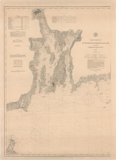
MapMaker: |
U.S. Coast & Geodetic Survey
|
|
| |
| |
Subject: |
Narragansett Bay, Rhode Island & Buzzards Bay, Massachusetts |
|
| |
Period/Size: |
1880 / 37.6" x 27.1" (95.5 x 68.9 cm)
|
|
| |
Color: |
Colored
|
|
| |
Condition: |
(B+) There is minor soiling, several faint extraneous creases, and a few edge tears just entering the neatline that have been closed on verso with archival tape. (condition help) |
|
| |
Source: |
|
|
| |
References: |
|
|
| |
|
|
| Sales Information |
| |
| |
Price: |
|
|
| |
| |
Offered by: |
Old World Auctions |
|
| |
Catalog: |
Auction No. 155 - Antique Maps, Charts, Atlases & Globes (9278) |
|
| |
Lot/Item #: |
299 |
|
| |
| |
Date: |
11/2015
|
|
| |
| |
|