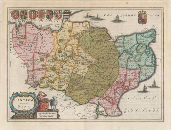
Title:
“Cantium Vernacule Kent”
Map Maker:
Johannes Blaeu
This handsome map of Kent extends to London at top... (full text available to subscribers)
| Item Detail |
| |
| |
MapMaker: |
Johannes Blaeu
|
|
| |
| |
Subject: |
Southeast England |
|
| |
Period/Size: |
1663 / 15.1" x 20.6" (38.4 x 52.4 cm)
|
|
| |
Color: |
Colored
|
|
| |
Condition: |
(A) A clean and bright example with a crisp impression and professional repairs to several minor separations along the centerfold. (condition help) |
|
| |
Source: |
Cinquieme Volume de la Geographie Blaviane |
|
| |
References: |
Van der Krogt (Vol. II) #5200:2. |
|
| |
|
|
| Sales Information |
| |
| |
Price: |
|
|
| |
| |
Offered by: |
Old World Auctions |
|
| |
Catalog: |
Auction No. 155 - Antique Maps, Charts, Atlases & Globes (9278) |
|
| |
Lot/Item #: |
432 |
|
| |
| |
Date: |
11/2015
|
|
| |
| |
|
Antique Maps - Valuation and Pricing, Descriptions, Resources |
|
Home |
Information |
Search |
Register |
Contact Us |
Site Map
Americana Exchange, Inc. © 1999 - 2024 Americana Exchange, Inc.. All rights reserved.
OldMaps.com, the OldMaps.com logo and
AMPR are service marks or registered service marks of Americana Exchange, Inc..
|