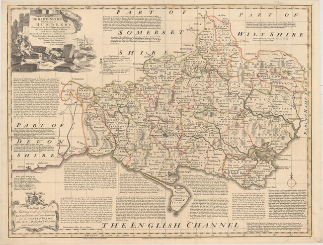
Title:
“An Accurate Map of Dorset Shire, Divided into Its Hundreds, Drawn from the Best Authorities...”
Map Maker:
Emanuel Bowen
This detailed map of the county of Dorset is divid... (full text available to subscribers)
| Item Detail |
| |
| |
MapMaker: |
Emanuel Bowen
|
|
| |
| |
Subject: |
Dorset, England |
|
| |
Period/Size: |
1752 / 21.1" x 27.5" (53.6 x 69.9 cm)
|
|
| |
Color: |
Colored
|
|
| |
Condition: |
(A) Original outline color with a professionally repaired short centerfold separation at bottom. (condition help) |
|
| |
Source: |
|
|
| |
References: |
|
|
| |
|
|
| Sales Information |
| |
| |
Price: |
|
|
| |
| |
Offered by: |
Old World Auctions |
|
| |
Catalog: |
Auction No. 155 - Antique Maps, Charts, Atlases & Globes (9278) |
|
| |
Lot/Item #: |
436 |
|
| |
| |
Date: |
11/2015
|
|
| |
| |
|
Antique Maps - Valuation and Pricing, Descriptions, Resources |
|
Home |
Information |
Search |
Register |
Contact Us |
Site Map
Americana Exchange, Inc. © 1999 - 2024 Americana Exchange, Inc.. All rights reserved.
OldMaps.com, the OldMaps.com logo and
AMPR are service marks or registered service marks of Americana Exchange, Inc..
|