Title:
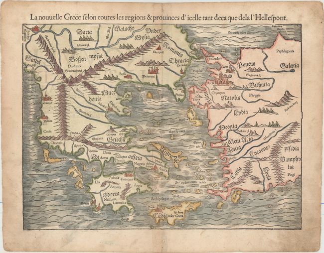
“La Nouvelle Grece Selon Toutes les Regions & Provinces d'Icelle tant Deca que dela l'Hellespont”
Map Maker:
Sebastian Munster
An early double-page woodblock map of Greece, the ... (full text available to subscribers)
| Item Detail |
| |
| |
MapMaker: |
Sebastian Munster
|
|
| |
| |
Subject: |
Greece |
|
| |
Period/Size: |
1552 / 10.1" x 13.8" (25.7 x 35.1 cm)
|
|
| |
Color: |
Colored
|
|
| |
Condition: |
(B+) Light soiling with professional repairs to two small holes along the centerfold in top and bottom blank margin, away from image. (condition help) |
|
| |
Source: |
Cosmographia |
|
| |
References: |
Zacharakis #1579; cf. Mickwitz & Miekkavaara #157-11. |
|
| |
|
|
| Sales Information |
| |
| |
Price: |
|
|
| |
| |
Offered by: |
Old World Auctions |
|
| |
Catalog: |
Auction No. 155 - Antique Maps, Charts, Atlases & Globes (9278) |
|
| |
Lot/Item #: |
527 |
|
| |
| |
Date: |
11/2015
|
|
| |
| |
|
Antique Maps - Valuation and Pricing, Descriptions, Resources |
|
Home |
Information |
Search |
Register |
Contact Us |
Site Map
Americana Exchange, Inc. © 1999 - 2024 Americana Exchange, Inc.. All rights reserved.
OldMaps.com, the OldMaps.com logo and
AMPR are service marks or registered service marks of Americana Exchange, Inc..
|