Title:
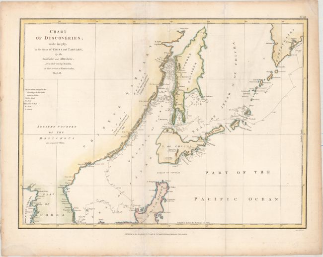
“Chart of Discoveries, Made in 1787, in the Seas of China and Tartary, by the Boussole and Astrolabe, from Their Leaving Manilla, to Their Arrival at Kamtschatka, Sheet II”
Map Maker:
Jean Francois Galaup de La Perouse
This chart shows the northern part of Japan, part ... (full text available to subscribers)
| Item Detail |
| |
| |
MapMaker: |
Jean Francois Galaup de La Perouse
|
|
| |
| |
Subject: |
Northeastern Asia, Japan |
|
| |
Period/Size: |
1798 / 14.2" x 19.3" (36.1 x 49.1 cm)
|
|
| |
Color: |
Colored
|
|
| |
Condition: |
(B+) Issued folding with light soiling, a couple of extraneous creases that have been pressed flat, and minor damp stains confined to the blank margins. (condition help) |
|
| |
Source: |
Charts and Plates to La Perouse's Voyage |
|
| |
References: |
|
|
| |
|
|
| Sales Information |
| |
| |
Price: |
|
|
| |
| |
Offered by: |
Old World Auctions |
|
| |
Catalog: |
Auction No. 155 - Antique Maps, Charts, Atlases & Globes (9278) |
|
| |
Lot/Item #: |
608 |
|
| |
| |
Date: |
11/2015
|
|
| |
| |
|
Antique Maps - Valuation and Pricing, Descriptions, Resources |
|
Home |
Information |
Search |
Register |
Contact Us |
Site Map
Americana Exchange, Inc. © 1999 - 2024 Americana Exchange, Inc.. All rights reserved.
OldMaps.com, the OldMaps.com logo and
AMPR are service marks or registered service marks of Americana Exchange, Inc..
|