Title:
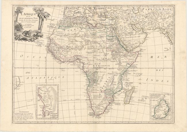
“L Afrique Divisee en Ses Principaux Etats Assujettie aux Observations Astronomique par le Sr. Janvier Geographe”
Map Maker:
Santini/Remondini
This handsome map of the continent shows the exten... (full text available to subscribers)
| Item Detail |
| |
| |
MapMaker: |
Santini/Remondini
|
|
| |
| |
Subject: |
Africa |
|
| |
Period/Size: |
1784 / 18.6" x 25.2" (47.3 x 64.0 cm)
|
|
| |
Color: |
Colored
|
|
| |
Condition: |
(A) On a sturdy watermarked sheet with faint damp stains at top and minor soiling that is mostly confined to the blank margins. (condition help) |
|
| |
Source: |
|
|
| |
References: |
|
|
| |
|
|
| Sales Information |
| |
| |
Price: |
|
|
| |
| |
Offered by: |
Old World Auctions |
|
| |
Catalog: |
Auction No. 155 - Antique Maps, Charts, Atlases & Globes (9278) |
|
| |
Lot/Item #: |
670 |
|
| |
| |
Date: |
11/2015
|
|
| |
| |
|
Antique Maps - Valuation and Pricing, Descriptions, Resources |
|
Home |
Information |
Search |
Register |
Contact Us |
Site Map
Americana Exchange, Inc. © 1999 - 2024 Americana Exchange, Inc.. All rights reserved.
OldMaps.com, the OldMaps.com logo and
AMPR are service marks or registered service marks of Americana Exchange, Inc..
|