| Item Detail |
| |
| |
MapMaker: |
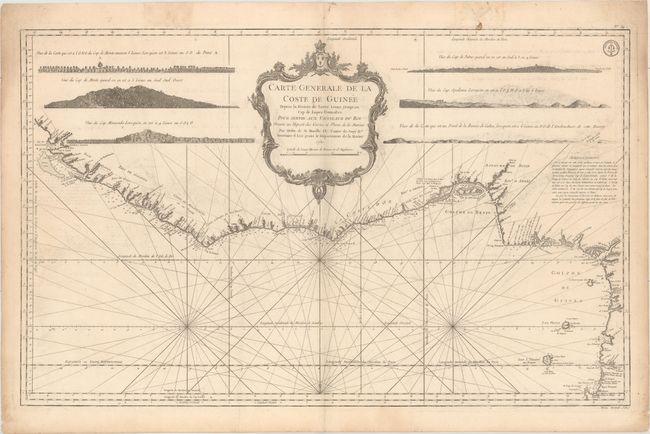
Jacques Nicolas Bellin
|
|
| |
| |
Subject: |
Western Africa |
|
| |
Period/Size: |
1750 / 21.8" x 34.9" (55.4 x 88.7 cm)
|
|
| |
Color: |
Black & White
|
|
| |
Condition: |
(B+) On a watermarked sheet with light offsetting, a few faint spots in the image, a few edge tears in the top blank margin that have been closed with archival materials, and marginal toning. (condition help) |
|
| |
Source: |
Hydrographique Francais |
|
| |
References: |
Phillips (A) #587- v. 2, 5. |
|
| |
|
|
| Sales Information |
| |
| |
Price: |
|
|
| |
| |
Offered by: |
Old World Auctions |
|
| |
Catalog: |
Auction No. 155 - Antique Maps, Charts, Atlases & Globes (9278) |
|
| |
Lot/Item #: |
681 |
|
| |
| |
Date: |
11/2015
|
|
| |
| |
|