Title:
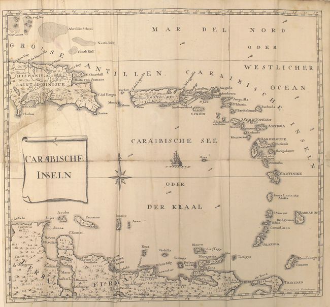
“Geschichte der Mission der Evangelischen Bruder auf den Caraibischen Inseln S. Thomas, S. Croix und S. Jan…”
Map Maker:
Johann Jakob Bossart
This is the fascinating history of the Moravian Mi... (full text available to subscribers)
| Item Detail |
| |
| |
MapMaker: |
Johann Jakob Bossart
|
|
| |
| |
Subject: |
Exploration & Surveys, US Virgin Islands |
|
| |
Period/Size: |
1777 / 7.5" x 4.5" (19.1 x 11.5 cm)
|
|
| |
Color: |
Black & White
|
|
| |
Condition: |
(B+) Overall very good condition with minor soiling and occasional foxing. The maps have crisp impressions with a few spots of foxing. The map of the Lesser Antilles has a 4" binding tear and the map of St. Thomas has a 2" tear that have both been close (condition help) |
|
| |
Source: |
|
|
| |
References: |
|
|
| |
|
|
| Sales Information |
| |
| |
Price: |
|
|
| |
| |
Offered by: |
Old World Auctions |
|
| |
Catalog: |
Auction No. 155 - Antique Maps, Charts, Atlases & Globes (9278) |
|
| |
Lot/Item #: |
757 |
|
| |
| |
Date: |
11/2015
|
|
| |
| |
|
Antique Maps - Valuation and Pricing, Descriptions, Resources |
|
Home |
Information |
Search |
Register |
Contact Us |
Site Map
Americana Exchange, Inc. © 1999 - 2024 Americana Exchange, Inc.. All rights reserved.
OldMaps.com, the OldMaps.com logo and
AMPR are service marks or registered service marks of Americana Exchange, Inc..
|