Title:
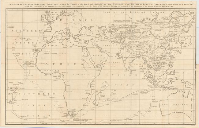
“A General Chart, on Mercator's Projection, to Shew the Track of the Lion and Hindostan from England to the Gulph of Pekin in China, and of Their Return to England...”
Map Maker:
Sir John Barrow
This is a reduced version of Barrow's large map fr... (full text available to subscribers)
| Item Detail |
| |
| |
MapMaker: |
Sir John Barrow
|
|
| |
| |
Subject: |
Eastern Hemisphere |
|
| |
Period/Size: |
1796 / 14.9" x 24.2" (37.9 x 61.5 cm)
|
|
| |
Color: |
Black & White
|
|
| |
Condition: |
(B+) Issued folding with light offsetting and a few short splits at fold intersections. There is a binding trim and associated 1/2" binding tear at right that has been closed on verso with archival tape. (condition help) |
|
| |
Source: |
|
|
| |
References: |
cf. Shirley (BL Atlases) G.BARR-1a #1. |
|
| |
|
|
| Sales Information |
| |
| |
Price: |
|
|
| |
| |
Offered by: |
Old World Auctions |
|
| |
Catalog: |
Auction No. 157 - Antique Maps, Charts, Atlases & Globes (9290) |
|
| |
Lot/Item #: |
52 |
|
| |
| |
Date: |
05/2016
|
|
| |
| |
|
Antique Maps - Valuation and Pricing, Descriptions, Resources |
|
Home |
Information |
Search |
Register |
Contact Us |
Site Map
Americana Exchange, Inc. © 1999 - 2024 Americana Exchange, Inc.. All rights reserved.
OldMaps.com, the OldMaps.com logo and
AMPR are service marks or registered service marks of Americana Exchange, Inc..
|