| Item Detail |
| |
| |
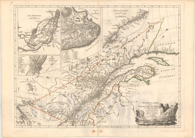
MapMaker: |
George Louis Le Rouge
|
|
| |
| |
Subject: |
Quebec, Eastern Canada |
|
| |
Period/Size: |
1777 / 19.0" x 25.9" (48.3 x 65.8 cm)
|
|
| |
Color: |
Colored
|
|
| |
Condition: |
(B+) A crisp impression with original outline color on watermarked paper. There is minor offsetting, a couple pairs of worm tracks around the centerfold at bottom, and marginal soiling. (condition help) |
|
| |
Source: |
Atlas Ameriquain |
|
| |
References: |
cf. Goss (NA) #61; Kershaw #1010; Shirley (BL Atlases) T.LER-3a #9. |
|
| |
|
|
| Sales Information |
| |
| |
Price: |
|
|
| |
| |
Offered by: |
Old World Auctions |
|
| |
Catalog: |
Auction No. 157 - Antique Maps, Charts, Atlases & Globes (9290) |
|
| |
Lot/Item #: |
124 |
|
| |
| |
Date: |
05/2016
|
|
| |
| |
|