| Item Detail |
| |
| |
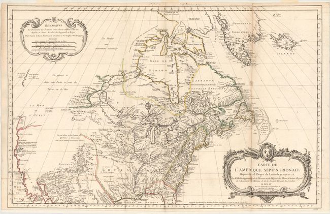
MapMaker: |
Jacques Nicolas Bellin
|
|
| |
| |
Subject: |
Colonial United States & Canada |
|
| |
Period/Size: |
1755 / 22.0" x 34.0" (55.9 x 86.4 cm)
|
|
| |
Color: |
Colored
|
|
| |
Condition: |
(B) Original outline color on a bright sheet with a few faint stains and light toning along one fold. Professionally backed with tissue to reattach a complete separation of the sheet below the bottom fold and to repair a long vertical fold separation. (condition help) |
|
| |
Source: |
|
|
| |
References: |
McGuirk #46; Tooley, MCC #96-762. |
|
| |
|
|
| Sales Information |
| |
| |
Price: |
|
|
| |
| |
Offered by: |
Old World Auctions |
|
| |
Catalog: |
Auction No. 157 - Antique Maps, Charts, Atlases & Globes (9290) |
|
| |
Lot/Item #: |
127 |
|
| |
| |
Date: |
05/2016
|
|
| |
| |
|