Title:
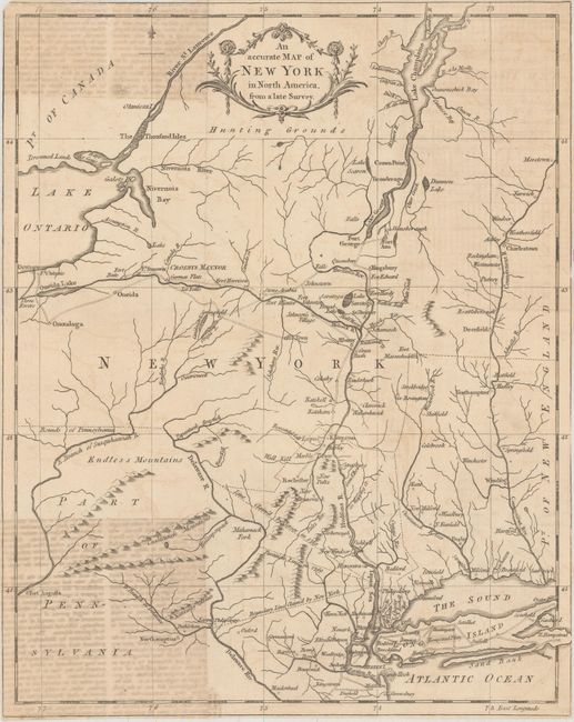
“An Accurate Map of New York in North America, from a Late Survey”
Map Maker:
Anonymous
Despite the title, this map centers on New York bu... (full text available to subscribers)
| Item Detail |
| |
| |
MapMaker: |
Anonymous
|
|
| |
| |
Subject: |
Colonial New England - United States |
|
| |
Period/Size: |
1780 / 13.3" x 10.6" (33.8 x 27.0 cm)
|
|
| |
Color: |
Black & White
|
|
| |
Condition: |
(B) Issued folding on watermarked paper with light offsetting from an opposing page of text in corners at left. A short fold separation and a 1" binding tear at right have been archivally repaired. Trimmed close to neatline on all sides. (condition help) |
|
| |
Source: |
Universal Magazine |
|
| |
References: |
Jolly #UNIV-187; Sellers & Van Ee #1112. |
|
| |
|
|
| Sales Information |
| |
| |
Price: |
|
|
| |
| |
Offered by: |
Old World Auctions |
|
| |
Catalog: |
Auction No. 157 - Antique Maps, Charts, Atlases & Globes (9290) |
|
| |
Lot/Item #: |
184 |
|
| |
| |
Date: |
05/2016
|
|
| |
| |
|
Antique Maps - Valuation and Pricing, Descriptions, Resources |
|
Home |
Information |
Search |
Register |
Contact Us |
Site Map
Americana Exchange, Inc. © 1999 - 2024 Americana Exchange, Inc.. All rights reserved.
OldMaps.com, the OldMaps.com logo and
AMPR are service marks or registered service marks of Americana Exchange, Inc..
|