Title:
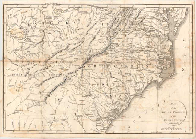
“Map of the Southern Provinces of the United States”
Map Maker:
Richard Phillips
This interesting map covers all of the Carolinas w... (full text available to subscribers)
| Item Detail |
| |
| |
MapMaker: |
Richard Phillips
|
|
| |
| |
Subject: |
Southeast United States |
|
| |
Period/Size: |
1804 / 13.6" x 19.9" (34.6 x 50.6 cm)
|
|
| |
Color: |
Black & White
|
|
| |
Condition: |
(B) Issued folding with scattered foxing and faint offsetting. A tear that extends 2" into the image at right has been closed on verso with archival tape. (condition help) |
|
| |
Source: |
Marshall's Life of Washington |
|
| |
References: |
Phillips (M) p. 873; Howes #M317. |
|
| |
|
|
| Sales Information |
| |
| |
Price: |
|
|
| |
| |
Offered by: |
Old World Auctions |
|
| |
Catalog: |
Auction No. 157 - Antique Maps, Charts, Atlases & Globes (9290) |
|
| |
Lot/Item #: |
211 |
|
| |
| |
Date: |
05/2016
|
|
| |
| |
|
Antique Maps - Valuation and Pricing, Descriptions, Resources |
|
Home |
Information |
Search |
Register |
Contact Us |
Site Map
Americana Exchange, Inc. © 1999 - 2024 Americana Exchange, Inc.. All rights reserved.
OldMaps.com, the OldMaps.com logo and
AMPR are service marks or registered service marks of Americana Exchange, Inc..
|