Title:
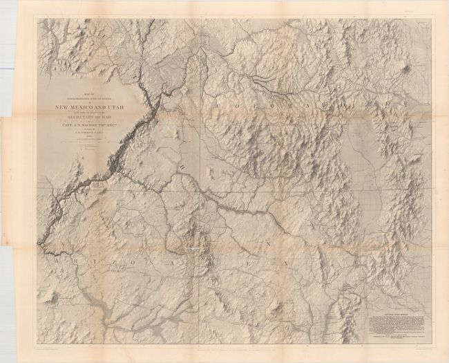
“Map of Explorations and Surveys in New Mexico and Utah…”
Map Maker:
John N. Macomb
Very rare, large map considered by Wheat to be a l... (full text available to subscribers)
| Item Detail |
| |
| |
MapMaker: |
John N. Macomb
|
|
| |
| |
Subject: |
Southwestern United States |
|
| |
Period/Size: |
1860 / 28.5" x 34.0" (72.4 x 86.4 cm)
|
|
| |
Color: |
Black & White
|
|
| |
Condition: |
(B) Issued folding with faint offsetting of the title and light toning along the folds. There are three splits at fold intersections that range in size from 1" to 4" with minute loss of image and one 6" separation along the left vertical fold. (condition help) |
|
| |
Source: |
|
|
| |
References: |
Wheat (TMW) #983. |
|
| |
|
|
| Sales Information |
| |
| |
Price: |
|
|
| |
| |
Offered by: |
Old World Auctions |
|
| |
Catalog: |
Auction No. 157 - Antique Maps, Charts, Atlases & Globes (9290) |
|
| |
Lot/Item #: |
248 |
|
| |
| |
Date: |
05/2016
|
|
| |
| |
|
Antique Maps - Valuation and Pricing, Descriptions, Resources |
|
Home |
Information |
Search |
Register |
Contact Us |
Site Map
Americana Exchange, Inc. © 1999 - 2024 Americana Exchange, Inc.. All rights reserved.
OldMaps.com, the OldMaps.com logo and
AMPR are service marks or registered service marks of Americana Exchange, Inc..
|