Title:
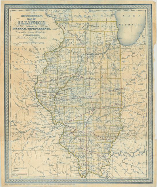
“Mitchell's Map of Illinois Exhibiting Its Internal Improvements, Counties, Towns, Roads &c.”
Map Maker:
Samuel Augustus Mitchell
This map of Illinois was printed in blue on thin, ... (full text available to subscribers)
| Item Detail |
| |
| |
MapMaker: |
Samuel Augustus Mitchell
|
|
| |
| |
Subject: |
Illinois |
|
| |
Period/Size: |
1838 / 15.0" x 12.5" (38.1 x 31.8 cm)
|
|
| |
Color: |
Colored
|
|
| |
Condition: |
(B+) Issued folding and now flattened. Reinforced with archival tape along the folds on verso to repair a few tiny fold separations. Light toning and a narrow, but adequate, right margin where the map was removed from its covers. (condition help) |
|
| |
Source: |
|
|
| |
References: |
|
|
| |
|
|
| Sales Information |
| |
| |
Price: |
|
|
| |
| |
Offered by: |
Old World Auctions |
|
| |
Catalog: |
Auction No. 157 - Antique Maps, Charts, Atlases & Globes (9290) |
|
| |
Lot/Item #: |
285 |
|
| |
| |
Date: |
05/2016
|
|
| |
| |
|
Antique Maps - Valuation and Pricing, Descriptions, Resources |
|
Home |
Information |
Search |
Register |
Contact Us |
Site Map
Americana Exchange, Inc. © 1999 - 2024 Americana Exchange, Inc.. All rights reserved.
OldMaps.com, the OldMaps.com logo and
AMPR are service marks or registered service marks of Americana Exchange, Inc..
|