| Item Detail |
| |
| |
MapMaker: |
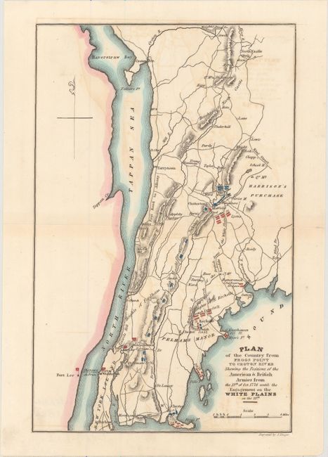
John Marshall
|
|
| |
| |
Subject: |
Southeastern New York, Revolutionary War |
|
| |
Period/Size: |
1832 / 9.6" x 6.2" (24.4 x 15.8 cm)
|
|
| |
Color: |
Colored
|
|
| |
Condition: |
(B) Faint offsetting with a complete centerfold separation that has been skillfully closed on verso with archival tape. (condition help) |
|
| |
Source: |
Marshall's Life of Washington |
|
| |
References: |
|
|
| |
|
|
| Sales Information |
| |
| |
Price: |
|
|
| |
| |
Offered by: |
Old World Auctions |
|
| |
Catalog: |
Auction No. 157 - Antique Maps, Charts, Atlases & Globes (9290) |
|
| |
Lot/Item #: |
304 |
|
| |
| |
Date: |
05/2016
|
|
| |
| |
|