| Item Detail |
| |
| |
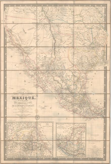
MapMaker: |
Adrien Hubert Brue
|
|
| |
| |
Subject: |
Western United States & Mexico, Texas, California |
|
| |
Period/Size: |
1840 / 37.1" x 26.0" (94.3 x 66.1 cm)
|
|
| |
Color: |
Colored
|
|
| |
Condition: |
(B) Issued folding with original outline color. There is minor toning, faint offsetting, and several small worm tracks primarily in the right third of the image. A number of creases and unobtrusive cracks along the border and into the map image were lik (condition help) |
|
| |
Source: |
|
|
| |
References: |
cf. Wheat (TMW) #404; cf. Rumsey #5386. |
|
| |
|
|
| Sales Information |
| |
| |
Price: |
|
|
| |
| |
Offered by: |
Old World Auctions |
|
| |
Catalog: |
Auction No. 157 - Antique Maps, Charts, Atlases & Globes (9290) |
|
| |
Lot/Item #: |
349 |
|
| |
| |
Date: |
05/2016
|
|
| |
| |
|