Title:
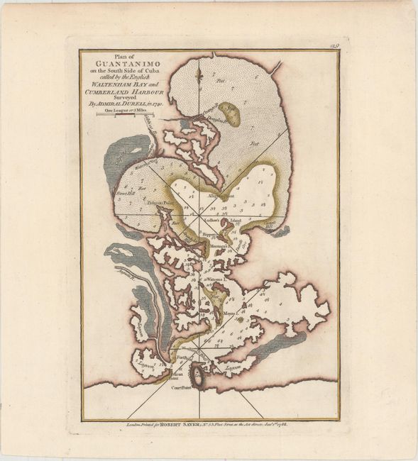
“Plan of Guantanimo on the South Side of Cuba Called by the English Waltenham Bay and Cumberland Harbour Surveyed by Admiral Durell, in 1740”
Map Maker:
Jefferys/Sayer
In 1741, during the War of Jenkins' Ear, British A... (full text available to subscribers)
| Item Detail |
| |
| |
MapMaker: |
Jefferys/Sayer
|
|
| |
| |
Subject: |
Guantanamo Bay, Cuba |
|
| |
Period/Size: |
1788 / 9.8" x 6.9" (24.9 x 17.6 cm)
|
|
| |
Color: |
Colored
|
|
| |
Condition: |
(A+) An excellent impression on watermarked paper. (condition help) |
|
| |
Source: |
A New and Accurate Chart of the West-India Islands... |
|
| |
References: |
Shirley (BL Atlases) M.SAY-4a #29. |
|
| |
|
|
| Sales Information |
| |
| |
Price: |
|
|
| |
| |
Offered by: |
Old World Auctions |
|
| |
Catalog: |
Auction No. 157 - Antique Maps, Charts, Atlases & Globes (9290) |
|
| |
Lot/Item #: |
381 |
|
| |
| |
Date: |
05/2016
|
|
| |
| |
|
Antique Maps - Valuation and Pricing, Descriptions, Resources |
|
Home |
Information |
Search |
Register |
Contact Us |
Site Map
Americana Exchange, Inc. © 1999 - 2024 Americana Exchange, Inc.. All rights reserved.
OldMaps.com, the OldMaps.com logo and
AMPR are service marks or registered service marks of Americana Exchange, Inc..
|