Title:
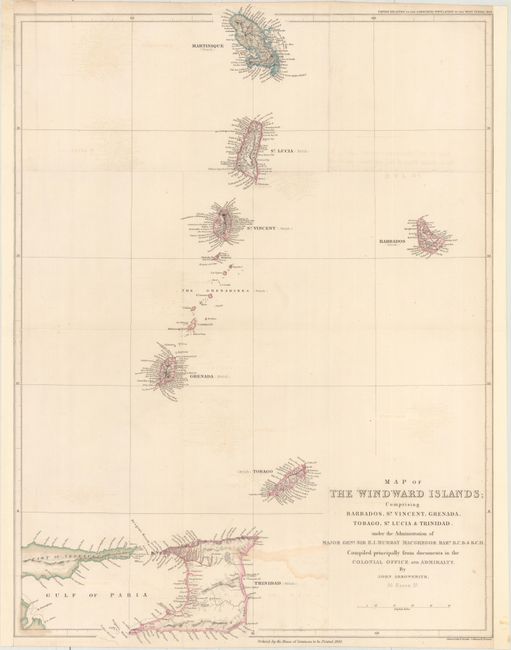
“Map of the Windward Islands; Comprising Barbados, St. Vincent, Grenada, Tobago, St. Lucia & Trinidad...”
Map Maker:
John Arrowsmith
This map of the Windward Islands spans from Martin... (full text available to subscribers)
| Item Detail |
| |
| |
MapMaker: |
John Arrowsmith
|
|
| |
| |
Subject: |
Windward Islands |
|
| |
Period/Size: |
1839 / 24.5" x 18.3" (62.3 x 46.5 cm)
|
|
| |
Color: |
Colored
|
|
| |
Condition: |
(B+) Original color. Backed with tissue to reinforce and repair a number of small separations along the folds and light offsetting. Remargined at left and right. (condition help) |
|
| |
Source: |
Papers Relating to the Labouring Population of the West Indies |
|
| |
References: |
|
|
| |
|
|
| Sales Information |
| |
| |
Price: |
|
|
| |
| |
Offered by: |
Old World Auctions |
|
| |
Catalog: |
Auction No. 157 - Antique Maps, Charts, Atlases & Globes (9290) |
|
| |
Lot/Item #: |
389 |
|
| |
| |
Date: |
05/2016
|
|
| |
| |
|
Antique Maps - Valuation and Pricing, Descriptions, Resources |
|
Home |
Information |
Search |
Register |
Contact Us |
Site Map
Americana Exchange, Inc. © 1999 - 2024 Americana Exchange, Inc.. All rights reserved.
OldMaps.com, the OldMaps.com logo and
AMPR are service marks or registered service marks of Americana Exchange, Inc..
|