Title:
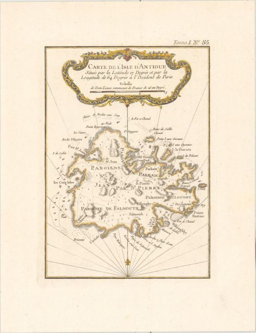
“Carte de l'Isle d'Antigue Situee par la Latitude 17 Degres et par la Longitude de 64 Degres a l'Occident de Paris”
Map Maker:
Jacques Nicolas Bellin
This fine small map of Antigua provides informatio... (full text available to subscribers)
| Item Detail |
| |
| |
MapMaker: |
Jacques Nicolas Bellin
|
|
| |
| |
Subject: |
Antigua |
|
| |
Period/Size: |
1764 / 7.9" x 5.7" (20.1 x 14.5 cm)
|
|
| |
Color: |
Colored
|
|
| |
Condition: |
(A) On a watermarked sheet. (condition help) |
|
| |
Source: |
Petit Atlas Maritime |
|
| |
References: |
Tooley (MCC-55) #32. |
|
| |
|
|
| Sales Information |
| |
| |
Price: |
|
|
| |
| |
Offered by: |
Old World Auctions |
|
| |
Catalog: |
Auction No. 157 - Antique Maps, Charts, Atlases & Globes (9290) |
|
| |
Lot/Item #: |
393 |
|
| |
| |
Date: |
05/2016
|
|
| |
| |
|
Antique Maps - Valuation and Pricing, Descriptions, Resources |
|
Home |
Information |
Search |
Register |
Contact Us |
Site Map
Americana Exchange, Inc. © 1999 - 2024 Americana Exchange, Inc.. All rights reserved.
OldMaps.com, the OldMaps.com logo and
AMPR are service marks or registered service marks of Americana Exchange, Inc..
|