| Item Detail |
| |
| |
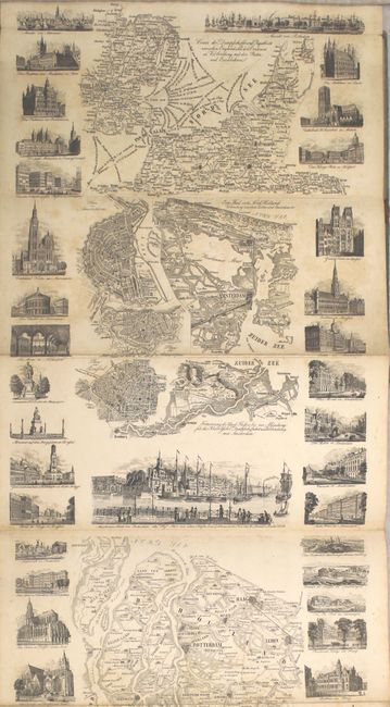
MapMaker: |
Friedrich Wilhelm Delkeskamp
|
|
| |
| |
Subject: |
Western Europe, Rhine River |
|
| |
Period/Size: |
1847 / 87.8" x 10.1" (223.1 x 25.7 cm)
|
|
| |
Color: |
Black & White
|
|
| |
Condition: |
(B) Light scattered foxing throughout but with no edge tears or fold separations, which is surprising for a map of this size. Text is very good and has separated from the inside front cover. Covers are stained with a large chip to the paper of the front (condition help) |
|
| |
Source: |
|
|
| |
References: |
|
|
| |
|
|
| Sales Information |
| |
| |
Price: |
|
|
| |
| |
Offered by: |
Old World Auctions |
|
| |
Catalog: |
Auction No. 157 - Antique Maps, Charts, Atlases & Globes (9290) |
|
| |
Lot/Item #: |
507 |
|
| |
| |
Date: |
05/2016
|
|
| |
| |
|