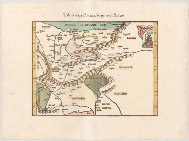
Title:
“Tabula Nova Poloniae, Ungariae, & Russiae”
Map Maker:
Ptolemy/Fries
This woodblock map is a "modern" map of eastern Eu... (full text available to subscribers)
| Item Detail |
| |
| |
MapMaker: |
Ptolemy/Fries
|
|
| |
| |
Subject: |
Eastern Europe |
|
| |
Period/Size: |
1541 / 11.0" x 14.4" (28.0 x 36.6 cm)
|
|
| |
Color: |
Colored
|
|
| |
Condition: |
(A) An excellent impression on paper with a bunch of grapes watermark and minor professional repairs along the centerfold in top and bottom blank margins. (condition help) |
|
| |
Source: |
Claudii Ptolemaei Alexandrini Geographicaeģ |
|
| |
References: |
Mickwitz & Miekkavaara #211-33. |
|
| |
|
|
| Sales Information |
| |
| |
Price: |
|
|
| |
| |
Offered by: |
Old World Auctions |
|
| |
Catalog: |
Auction No. 157 - Antique Maps, Charts, Atlases & Globes (9290) |
|
| |
Lot/Item #: |
542 |
|
| |
| |
Date: |
05/2016
|
|
| |
| |
|
Antique Maps - Valuation and Pricing, Descriptions, Resources |
|
Home |
Information |
Search |
Register |
Contact Us |
Site Map
Americana Exchange, Inc. © 1999 - 2024 Americana Exchange, Inc.. All rights reserved.
OldMaps.com, the OldMaps.com logo and
AMPR are service marks or registered service marks of Americana Exchange, Inc..
|