| Item Detail |
| |
| |
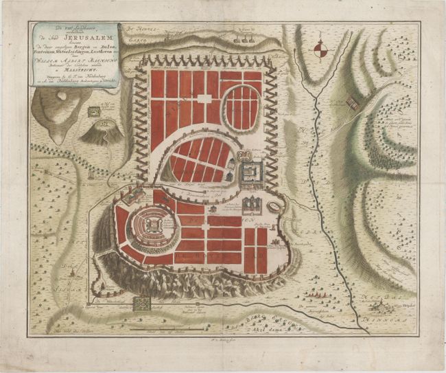
MapMaker: |
Willem Albert Bachiene
|
|
| |
| |
Subject: |
Jerusalem, Holy Land |
|
| |
Period/Size: |
1750 / 12.8" x 15.9" (32.6 x 40.4 cm)
|
|
| |
Color: |
Colored
|
|
| |
Condition: |
(A) A clean and crisp example on watermarked paper with a light horizontal crease and a very faint damp stain at bottom. (condition help) |
|
| |
Source: |
Heilige Geographie of Aardrijkskundige Beschryving van het Joodsche Land |
|
| |
References: |
cf. Laor #948; Poortman & Augusteijn #186. |
|
| |
|
|
| Sales Information |
| |
| |
Price: |
|
|
| |
| |
Offered by: |
Old World Auctions |
|
| |
Catalog: |
Auction No. 157 - Antique Maps, Charts, Atlases & Globes (9290) |
|
| |
Lot/Item #: |
626 |
|
| |
| |
Date: |
05/2016
|
|
| |
| |
|