| Item Detail |
| |
| |
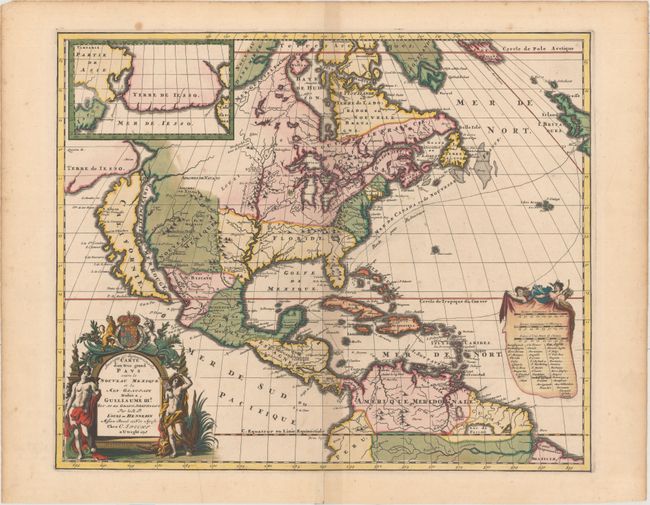
MapMaker: |
Louis de Hennepin
|
|
| |
| |
Subject: |
North America |
|
| |
Period/Size: |
1698 / 17.0" x 20.7" (43.2 x 52.6 cm)
|
|
| |
Color: |
Colored
|
|
| |
Condition: |
(B+) A crisp impression with full original color, minor toning along the centerfold, and a professionally repaired centerfold separation that just enters the map border at bottom. There are several small stains confined to the blank margins, and remnants (condition help) |
|
| |
Source: |
|
|
| |
References: |
Burden #738; Goss (NA) #47; McCorkle #697.2; McLauglin #124-2; Tooley p. 125 #59; Wagner (NW) #452. |
|
| |
|
|
| Sales Information |
| |
| |
Price: |
|
|
| |
| |
Offered by: |
Old World Auctions |
|
| |
Catalog: |
Auction No. 156 - Antique Maps, Charts, Atlases & Globes (9289) |
|
| |
Lot/Item #: |
82 |
|
| |
| |
Date: |
02/2016
|
|
| |
| |
|