| Item Detail |
| |
| |
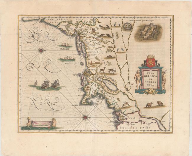
MapMaker: |
Willem Blaeu
|
|
| |
| |
Subject: |
Colonial New England & Mid-Atlantic |
|
| |
Period/Size: |
1642 / 15.4" x 19.9" (39.2 x 50.6 cm)
|
|
| |
Color: |
Colored
|
|
| |
Condition: |
(B+) A sharp impression with full original color, wide margins, and light show-through of text on verso. There are professional repairs to several separations along the centerfold as well as a few chips and tears confined to the far blank margins. (condition help) |
|
| |
Source: |
|
|
| |
References: |
Burden #241; Goss (Blaeu) p. 164; McCorkle #635.1; Van der Krogt (Vol. II) #9310:2. |
|
| |
|
|
| Sales Information |
| |
| |
Price: |
|
|
| |
| |
Offered by: |
Old World Auctions |
|
| |
Catalog: |
Auction No. 156 - Antique Maps, Charts, Atlases & Globes (9289) |
|
| |
Lot/Item #: |
172 |
|
| |
| |
Date: |
02/2016
|
|
| |
| |
|