| Item Detail |
| |
| |
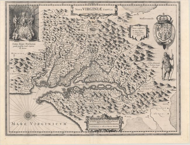
MapMaker: |
Henricus Hondius
|
|
| |
| |
Subject: |
Colonial Mid-Atlantic United States |
|
| |
Period/Size: |
1630 / 15.1" x 19.6" (38.4 x 49.8 cm)
|
|
| |
Color: |
Black & White
|
|
| |
Condition: |
(B+) A dark, crisp impression with a couple of tiny spots. Professionally backed on linen to repair a short centerfold separation at top, two tears that enter 0.5" and 2.5" into image at bottom center, and a chip in the far blank margin at bottom right. (condition help) |
|
| |
Source: |
Atlas Maioris Appendix, sive Pars Altera… |
|
| |
References: |
Burden #228; Tooley (Amer) pp. 165-66; Van der Krogt (Vol. I) #9410:1. |
|
| |
|
|
| Sales Information |
| |
| |
Price: |
|
|
| |
| |
Offered by: |
Old World Auctions |
|
| |
Catalog: |
Auction No. 156 - Antique Maps, Charts, Atlases & Globes (9289) |
|
| |
Lot/Item #: |
183 |
|
| |
| |
Date: |
02/2016
|
|
| |
| |
|