| Item Detail |
| |
| |
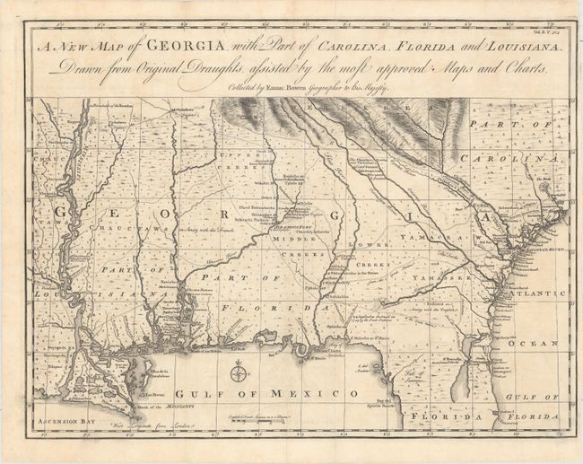
MapMaker: |
Emanuel Bowen
|
|
| |
| |
Subject: |
Colonial Southeast United States |
|
| |
Period/Size: |
1763 / 14.3" x 18.8" (36.4 x 47.8 cm)
|
|
| |
Color: |
Black & White
|
|
| |
Condition: |
(A) A crisp impression, issued folding with minor offsetting. There is a narrow, but adequate, right side margin. (condition help) |
|
| |
Source: |
Harris' A Complete Collection of Voyages and Travels |
|
| |
References: |
Cumming #267; TMC, Issue 19, p.27-31. |
|
| |
|
|
| Sales Information |
| |
| |
Price: |
|
|
| |
| |
Offered by: |
Old World Auctions |
|
| |
Catalog: |
Auction No. 156 - Antique Maps, Charts, Atlases & Globes (9289) |
|
| |
Lot/Item #: |
202 |
|
| |
| |
Date: |
02/2016
|
|
| |
| |
|