Title:
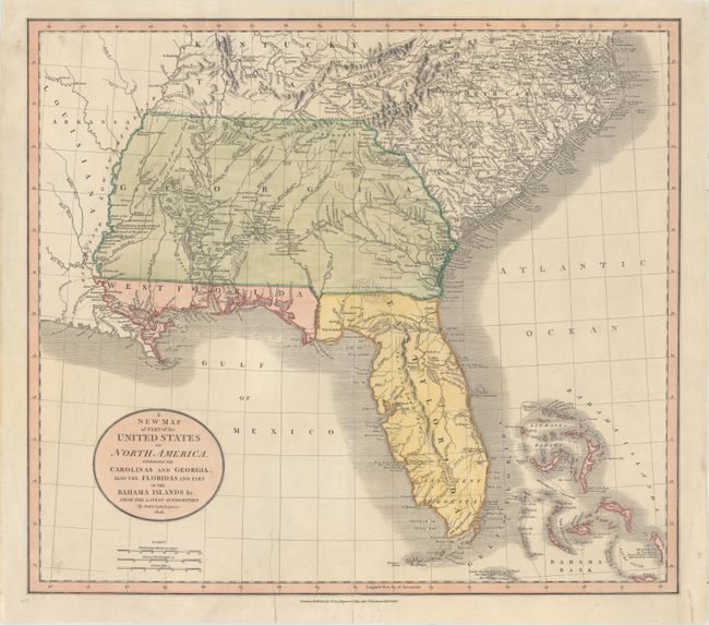
“A New Map of Part of the United States of North America, Containing the Carolinas and Georgia. Also the Floridas and Part of the Bahama Islands &c. from the Latest Authorities”
Map Maker:
John Cary
This is a wonderful map of the Southeast issued du... (full text available to subscribers)
| Item Detail |
| |
| |
MapMaker: |
John Cary
|
|
| |
| |
Subject: |
Southeast United States |
|
| |
Period/Size: |
1806 / 18.3" x 20.8" (46.5 x 52.9 cm)
|
|
| |
Color: |
Colored
|
|
| |
Condition: |
(B+) Nice impression and color on watermarked paper that has been backed with tissue to repair an edge tear that extends 2" into the image at bottom. Minor soiling mostly in the blank margins. (condition help) |
|
| |
Source: |
New Universal Atlas |
|
| |
References: |
Phillips (Maps) p. 876. |
|
| |
|
|
| Sales Information |
| |
| |
Price: |
|
|
| |
| |
Offered by: |
Old World Auctions |
|
| |
Catalog: |
Auction No. 156 - Antique Maps, Charts, Atlases & Globes (9289) |
|
| |
Lot/Item #: |
206 |
|
| |
| |
Date: |
02/2016
|
|
| |
| |
|
Antique Maps - Valuation and Pricing, Descriptions, Resources |
|
Home |
Information |
Search |
Register |
Contact Us |
Site Map
Americana Exchange, Inc. © 1999 - 2024 Americana Exchange, Inc.. All rights reserved.
OldMaps.com, the OldMaps.com logo and
AMPR are service marks or registered service marks of Americana Exchange, Inc..
|