| Item Detail |
| |
| |
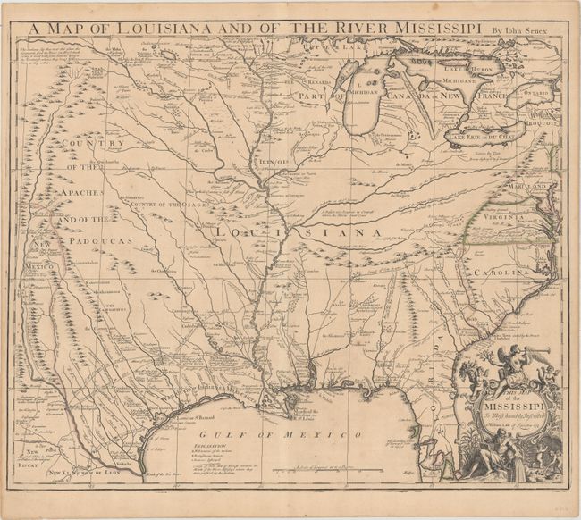
MapMaker: |
John Senex
|
|
| |
| |
Subject: |
South Central United States, Louisiana |
|
| |
Period/Size: |
1721 / 19.1" x 22.7" (48.6 x 57.7 cm)
|
|
| |
Color: |
Colored
|
|
| |
Condition: |
(B+) A nice impression on watermarked paper with original outline color. There is faint toning and a couple of unobtrusive spots of foxing. (condition help) |
|
| |
Source: |
New General Atlas |
|
| |
References: |
Cumming (SE) #182; Lemmon, Magill & Wiese plt. 21; Wheat (TMW) #100. |
|
| |
|
|
| Sales Information |
| |
| |
Price: |
|
|
| |
| |
Offered by: |
Old World Auctions |
|
| |
Catalog: |
Auction No. 156 - Antique Maps, Charts, Atlases & Globes (9289) |
|
| |
Lot/Item #: |
214 |
|
| |
| |
Date: |
02/2016
|
|
| |
| |
|