| Item Detail |
| |
| |
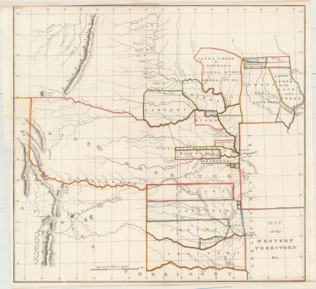
MapMaker: |
Washington Hood
|
|
| |
| |
Subject: |
Central United States |
|
| |
Period/Size: |
1834 / 17.1" x 18.0" (43.5 x 45.8 cm)
|
|
| |
Color: |
Colored
|
|
| |
Condition: |
(B+) Issued folding, now flattened. Usual binding trim at left with a short binding tear professionally repaired. Trimmed close at bottom right and into neatline at top left, with paper laid in to facilitate framing. (condition help) |
|
| |
Source: |
Horace Everett's Regulating The Indian Department... |
|
| |
References: |
Wheat (TMW) #405. |
|
| |
|
|
| Sales Information |
| |
| |
Price: |
|
|
| |
| |
Offered by: |
Old World Auctions |
|
| |
Catalog: |
Auction No. 156 - Antique Maps, Charts, Atlases & Globes (9289) |
|
| |
Lot/Item #: |
217 |
|
| |
| |
Date: |
02/2016
|
|
| |
| |
|