Title:
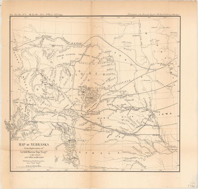
“Map of Nebraska from Explorations of Lt. G.K. Warren Topl. Engrs. in 1855, 56, & 57, and Other Authorities”
Map Maker:
U.S. War Department
This map of the northwestern Great Plains covers t... (full text available to subscribers)
| Item Detail |
| |
| |
MapMaker: |
U.S. War Department
|
|
| |
| |
Subject: |
Central United States |
|
| |
Period/Size: |
1857 / 9.2" x 10.1" (23.4 x 25.7 cm)
|
|
| |
Color: |
Black & White
|
|
| |
Condition: |
(B) Backed with tissue to reinforce and repair a 1.25" tear just outside of the left neatline in the Great Salt Lake and one tiny split at a fold intersection. Light toning along the folds and faint offsetting. Small binding trim at lower left replaced (condition help) |
|
| |
Source: |
Sen. Ex. Doc. No. 1, 35th Congress, 2nd Session |
|
| |
References: |
Wheat (TMW) #937. |
|
| |
|
|
| Sales Information |
| |
| |
Price: |
|
|
| |
| |
Offered by: |
Old World Auctions |
|
| |
Catalog: |
Auction No. 156 - Antique Maps, Charts, Atlases & Globes (9289) |
|
| |
Lot/Item #: |
220 |
|
| |
| |
Date: |
02/2016
|
|
| |
| |
|
Antique Maps - Valuation and Pricing, Descriptions, Resources |
|
Home |
Information |
Search |
Register |
Contact Us |
Site Map
Americana Exchange, Inc. © 1999 - 2024 Americana Exchange, Inc.. All rights reserved.
OldMaps.com, the OldMaps.com logo and
AMPR are service marks or registered service marks of Americana Exchange, Inc..
|