Title:
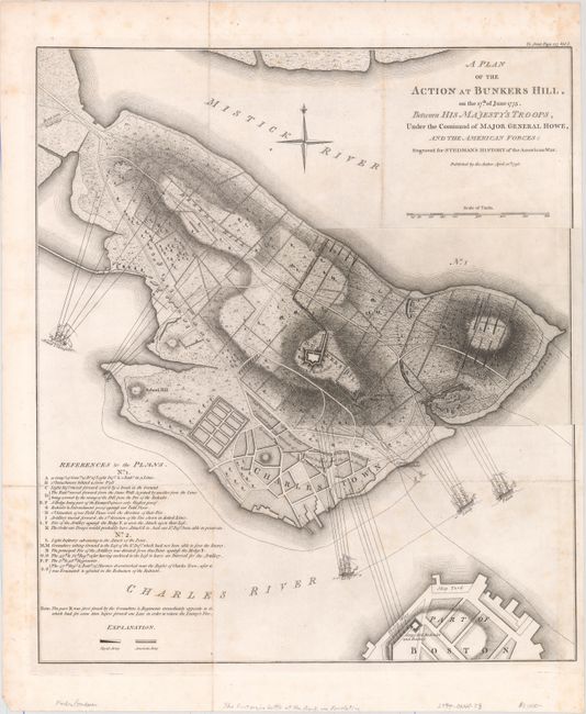
“A Plan of the Action at Bunkers Hill, on the 17th of June 1775. Between His Majesty's Troops, Under the Command of Major General Howe, and the American Forces: Engraved for Stedman's History of the American War”
Map Maker:
Charles Stedman
This is the second state of the famous 1775 map by... (full text available to subscribers)
| Item Detail |
| |
| |
MapMaker: |
Charles Stedman
|
|
| |
| |
Subject: |
Boston, Massachusetts |
|
| |
Period/Size: |
1793 / 19.2" x 16.9" (48.8 x 43.0 cm)
|
|
| |
Color: |
Black & White
|
|
| |
Condition: |
(B+) A crisp impression issued folding on sturdy paper with light scattered foxing. Small remnants of hinge tape on verso. (condition help) |
|
| |
Source: |
History of the Origin, Progress, and Termination of the American War |
|
| |
References: |
Nebenzahl (Biblio) #29; cf. Nebenzahl & Higginbotham (Amer. Rev.) #4. |
|
| |
|
|
| Sales Information |
| |
| |
Price: |
|
|
| |
| |
Offered by: |
Old World Auctions |
|
| |
Catalog: |
Auction No. 156 - Antique Maps, Charts, Atlases & Globes (9289) |
|
| |
Lot/Item #: |
276 |
|
| |
| |
Date: |
02/2016
|
|
| |
| |
|
Antique Maps - Valuation and Pricing, Descriptions, Resources |
|
Home |
Information |
Search |
Register |
Contact Us |
Site Map
Americana Exchange, Inc. © 1999 - 2024 Americana Exchange, Inc.. All rights reserved.
OldMaps.com, the OldMaps.com logo and
AMPR are service marks or registered service marks of Americana Exchange, Inc..
|