Title:
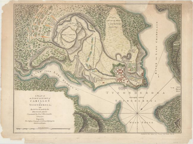
“A Plan of the Town and Fort of Carillon at Ticonderoga; with the Attack Made by the British Army Commanded by Genl. Abercrombie, 8 July 1758”
Map Maker:
Thomas Jefferys
This scarce map depicts the Battle of Carillon, al... (full text available to subscribers)
| Item Detail |
| |
| |
MapMaker: |
Thomas Jefferys
|
|
| |
| |
Subject: |
Ticonderoga, New York |
|
| |
Period/Size: |
1768 / 14.6" x 18.9" (37.1 x 48.0 cm)
|
|
| |
Color: |
Colored
|
|
| |
Condition: |
(B) Nice impression and color on watermarked paper with light soiling. Backed in tissue to repair a number of chips and tears along the edges of the sheet, including four tears that enter between 1/2" and 2" into image at top. A 1" by 2.5" chip at top i (condition help) |
|
| |
Source: |
A General Topography of North America and the West Indies |
|
| |
References: |
Phillips (Maps) #1196-36; Sellers & Van Ee #1120. |
|
| |
|
|
| Sales Information |
| |
| |
Price: |
|
|
| |
| |
Offered by: |
Old World Auctions |
|
| |
Catalog: |
Auction No. 156 - Antique Maps, Charts, Atlases & Globes (9289) |
|
| |
Lot/Item #: |
290 |
|
| |
| |
Date: |
02/2016
|
|
| |
| |
|
Antique Maps - Valuation and Pricing, Descriptions, Resources |
|
Home |
Information |
Search |
Register |
Contact Us |
Site Map
Americana Exchange, Inc. © 1999 - 2024 Americana Exchange, Inc.. All rights reserved.
OldMaps.com, the OldMaps.com logo and
AMPR are service marks or registered service marks of Americana Exchange, Inc..
|