| Item Detail |
| |
| |
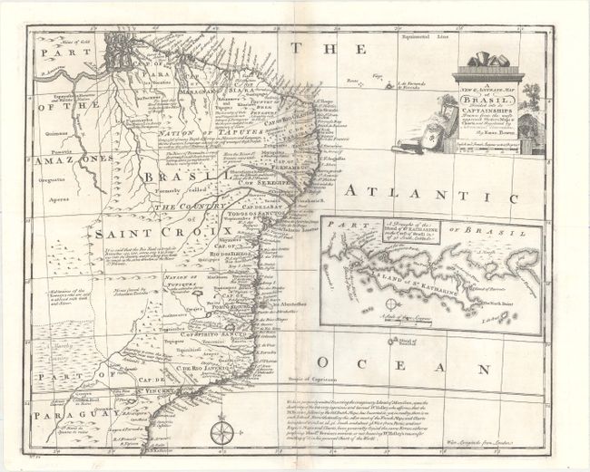
MapMaker: |
Emanuel Bowen
|
|
| |
| |
Subject: |
Brazil |
|
| |
Period/Size: |
1747 / 13.8" x 16.8" (35.1 x 42.7 cm)
|
|
| |
Color: |
Black & White
|
|
| |
Condition: |
(B+) A dark impression on a clean sheet with the backstrap on verso being visible along the centerfold. The centerfold has been backed with archival tape on verso to reinforce and repair several small separations. (condition help) |
|
| |
Source: |
A Complete System of Geography… |
|
| |
References: |
McCorkle (18th c. Geography Books) #17-22 (Vol II); Shirley (BL Atlases) T.BOW-2a #52. |
|
| |
|
|
| Sales Information |
| |
| |
Price: |
|
|
| |
| |
Offered by: |
Old World Auctions |
|
| |
Catalog: |
Auction No. 156 - Antique Maps, Charts, Atlases & Globes (9289) |
|
| |
Lot/Item #: |
396 |
|
| |
| |
Date: |
02/2016
|
|
| |
| |
|