Title:
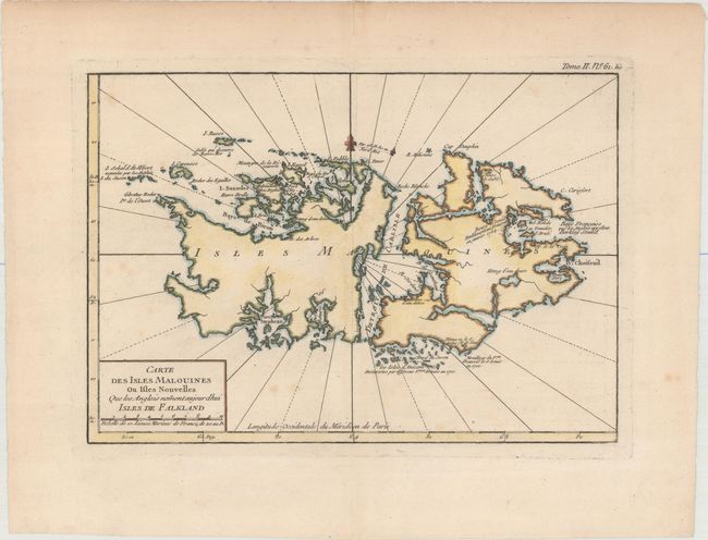
“Carte des Isles Malouines ou Isles Nouvelles que les Anglois Noment Aujourdhui Isles de Falkland”
Map Maker:
Jacques Nicolas Bellin
This chart of the Falkland islands depicts safe an... (full text available to subscribers)
| Item Detail |
| |
| |
MapMaker: |
Jacques Nicolas Bellin
|
|
| |
| |
Subject: |
Falkland Islands |
|
| |
Period/Size: |
1764 / 8.3" x 11.9" (21.1 x 30.3 cm)
|
|
| |
Color: |
Colored
|
|
| |
Condition: |
(B+) A crisp impression with attractive color on watermarked paper. There area few light spots of foxing and a hint of offsetting. (condition help) |
|
| |
Source: |
Petit Atlas Maritime |
|
| |
References: |
Fordham (MCC-11) #6. |
|
| |
|
|
| Sales Information |
| |
| |
Price: |
|
|
| |
| |
Offered by: |
Old World Auctions |
|
| |
Catalog: |
Auction No. 156 - Antique Maps, Charts, Atlases & Globes (9289) |
|
| |
Lot/Item #: |
412 |
|
| |
| |
Date: |
02/2016
|
|
| |
| |
|
Antique Maps - Valuation and Pricing, Descriptions, Resources |
|
Home |
Information |
Search |
Register |
Contact Us |
Site Map
Americana Exchange, Inc. © 1999 - 2024 Americana Exchange, Inc.. All rights reserved.
OldMaps.com, the OldMaps.com logo and
AMPR are service marks or registered service marks of Americana Exchange, Inc..
|