Title:
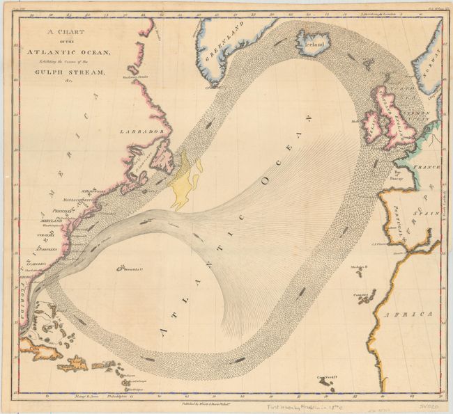
“A Chart of the Atlantic Ocean, Exhibiting the Course of the Gulph Stream, &c.”
Map Maker:
Benjamin Franklin
Benjamin Franklin first published his groundbreaki... (full text available to subscribers)
| Item Detail |
| |
| |
MapMaker: |
Benjamin Franklin
|
|
| |
| |
Subject: |
North Atlantic |
|
| |
Period/Size: |
1834 / 12.3" x 13.8" (31.3 x 35.1 cm)
|
|
| |
Color: |
Colored
|
|
| |
Condition: |
(A) Issued folding with a couple of tiny spots of foxing and faint offsetting from an opposing page of text at top left. Binding trim at lower right. (condition help) |
|
| |
Source: |
Memoirs of the Life and Writings of Benjamin Franklin |
|
| |
References: |
|
|
| |
|
|
| Sales Information |
| |
| |
Price: |
|
|
| |
| |
Offered by: |
Old World Auctions |
|
| |
Catalog: |
Auction No. 156 - Antique Maps, Charts, Atlases & Globes (9289) |
|
| |
Lot/Item #: |
417 |
|
| |
| |
Date: |
02/2016
|
|
| |
| |
|
Antique Maps - Valuation and Pricing, Descriptions, Resources |
|
Home |
Information |
Search |
Register |
Contact Us |
Site Map
Americana Exchange, Inc. © 1999 - 2024 Americana Exchange, Inc.. All rights reserved.
OldMaps.com, the OldMaps.com logo and
AMPR are service marks or registered service marks of Americana Exchange, Inc..
|