| Item Detail |
| |
| |
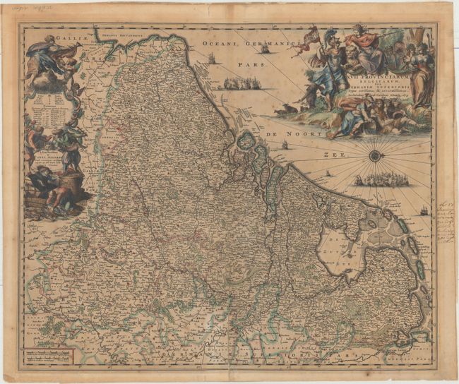
MapMaker: |
Carel Allard
|
|
| |
| |
Subject: |
Low Countries |
|
| |
Period/Size: |
1675 / 18.4" x 22.1" (46.8 x 56.2 cm)
|
|
| |
Color: |
Colored
|
|
| |
Condition: |
(B) A strong impression with toning, scattered foxing, and a 4.5" fold separation at bottom that has been repaired on verso with archival material. Manuscript notations are confined to the right blank margin and the verso has paper tape along sheet edges (condition help) |
|
| |
Source: |
|
|
| |
References: |
|
|
| |
|
|
| Sales Information |
| |
| |
Price: |
|
|
| |
| |
Offered by: |
Old World Auctions |
|
| |
Catalog: |
Auction No. 156 - Antique Maps, Charts, Atlases & Globes (9289) |
|
| |
Lot/Item #: |
469 |
|
| |
| |
Date: |
02/2016
|
|
| |
| |
|