Title:
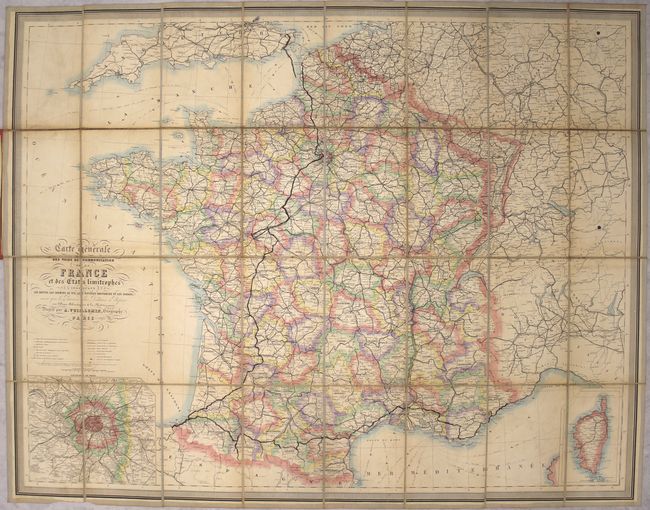
“Carte Generale des Voies de Communication de la France et des Etats Limitrophes Indiquant les Routes, les Chemins de Fer, les Rivieres Navigables et les Canaux...”
Map Maker:
Alexander A. Vuillemin
This folding map of France is dense with detail. ... (full text available to subscribers)
| Item Detail |
| |
| |
MapMaker: |
Alexander A. Vuillemin
|
|
| |
| |
Subject: |
France |
|
| |
Period/Size: |
1870 / 25.8" x 33.0" (65.6 x 83.9 cm)
|
|
| |
Color: |
Colored
|
|
| |
Condition: |
(B) There is some minor offsetting, light soiling, and light toning primarily along the folds. There are manuscript notations in blank ink from a previous owner. There is wear and a light stain on the covers. (condition help) |
|
| |
Source: |
|
|
| |
References: |
|
|
| |
|
|
| Sales Information |
| |
| |
Price: |
|
|
| |
| |
Offered by: |
Old World Auctions |
|
| |
Catalog: |
Auction No. 156 - Antique Maps, Charts, Atlases & Globes (9289) |
|
| |
Lot/Item #: |
477 |
|
| |
| |
Date: |
02/2016
|
|
| |
| |
|
Antique Maps - Valuation and Pricing, Descriptions, Resources |
|
Home |
Information |
Search |
Register |
Contact Us |
Site Map
Americana Exchange, Inc. © 1999 - 2024 Americana Exchange, Inc.. All rights reserved.
OldMaps.com, the OldMaps.com logo and
AMPR are service marks or registered service marks of Americana Exchange, Inc..
|