Title:
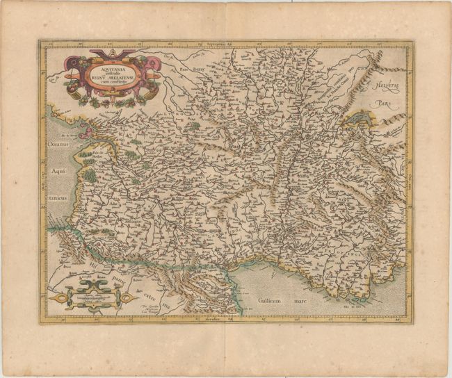
“Aquitania Australis Regnu Arelatense cum Consinijs”
Map Maker:
Mercator/Hondius
An attractive map of southern France, embellished ... (full text available to subscribers)
| Item Detail |
| |
| |
MapMaker: |
Mercator/Hondius
|
|
| |
| |
Subject: |
Southern France |
|
| |
Period/Size: |
1619 / 14.0" x 18.4" (35.6 x 46.8 cm)
|
|
| |
Color: |
Colored
|
|
| |
Condition: |
(B+) Full original color on watermarked paper with very light toning and minor foxing confined to the blank margins. (condition help) |
|
| |
Source: |
Gerardi Mercatoris - Atlas sive Cosmographicae |
|
| |
References: |
Van der Krogt (Vol. I) #4002:1. |
|
| |
|
|
| Sales Information |
| |
| |
Price: |
|
|
| |
| |
Offered by: |
Old World Auctions |
|
| |
Catalog: |
Auction No. 156 - Antique Maps, Charts, Atlases & Globes (9289) |
|
| |
Lot/Item #: |
486 |
|
| |
| |
Date: |
02/2016
|
|
| |
| |
|
Antique Maps - Valuation and Pricing, Descriptions, Resources |
|
Home |
Information |
Search |
Register |
Contact Us |
Site Map
Americana Exchange, Inc. © 1999 - 2024 Americana Exchange, Inc.. All rights reserved.
OldMaps.com, the OldMaps.com logo and
AMPR are service marks or registered service marks of Americana Exchange, Inc..
|