| Item Detail |
| |
| |
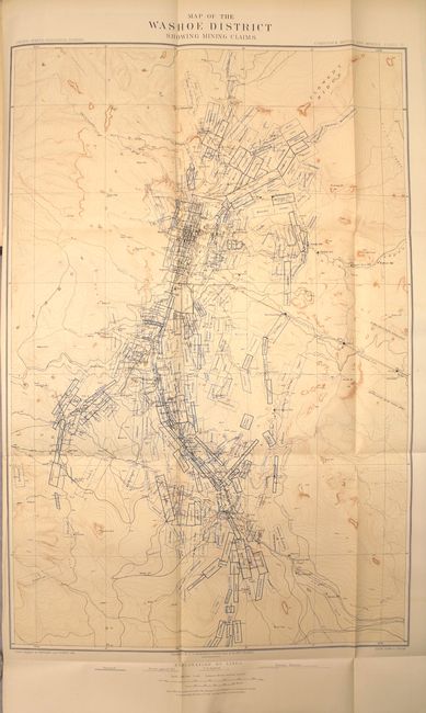
MapMaker: |
U.S. Geographical Survey
|
|
| |
| |
Subject: |
Exploration & Surveys, United States |
|
| |
Period/Size: |
1883 / 12.0" x 9.5" (30.5 x 24.2 cm)
|
|
| |
Color: |
Colored
|
|
| |
Condition: |
(A) Maps and text are near fine with pleasant even-age toning. The one exception is the map of the Placerville Route which was detached along the left fold and skillfully reattached with archival tape (B) - see images. Covers and spine show typical shel (condition help) |
|
| |
Source: |
|
|
| |
References: |
|
|
| |
|
|
| Sales Information |
| |
| |
Price: |
|
|
| |
| |
Offered by: |
Old World Auctions |
|
| |
Catalog: |
Auction No. 156 - Antique Maps, Charts, Atlases & Globes (9289) |
|
| |
Lot/Item #: |
812 |
|
| |
| |
Date: |
02/2016
|
|
| |
| |
|